

Fact-check: Pentagon maps disprove claims of Indian, Pakistani airspace use to bomb Iran
As per the information that is publicly available till now, there is no indication that either Pakistani or Indian airspace was used


 Updated Monday Jun 23 2025
Soon after the United States bombed Iranian nuclear sites on June 22, claims began circulating on social media alleging that US aircrafts used either Pakistani or Indian airspace to carry out the strikes.
Both claims are false.
Claim
On June 22, a user on X (formerly Twitter) wrote: "Pakistani airspace was used by the United States to bomb Iranian nuclear sites. Afghan intelligence has confirmed this."
In response, Pakistani Senator Sherry Rehman, among various other Pakistani users, denied the allegation against Pakistan, but instead claimed: “Indian airspace was used to bomb Iran, as now confirmed publicly by US official sources.”
Pakistan's minister for defence also shared a similar claim on X.
Adding to the confusion, Pakistan's local media outlet reported, citing "defence sources", that US B-2 Spirit stealth bombers flying from Guam entered Iranian airspace via India.
Fact
Official maps and flight paths released by the United States debunk claims that either Pakistani or Indian airspace was used in the operation.
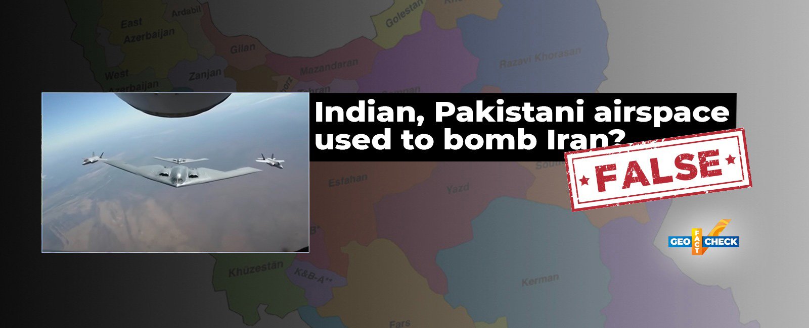
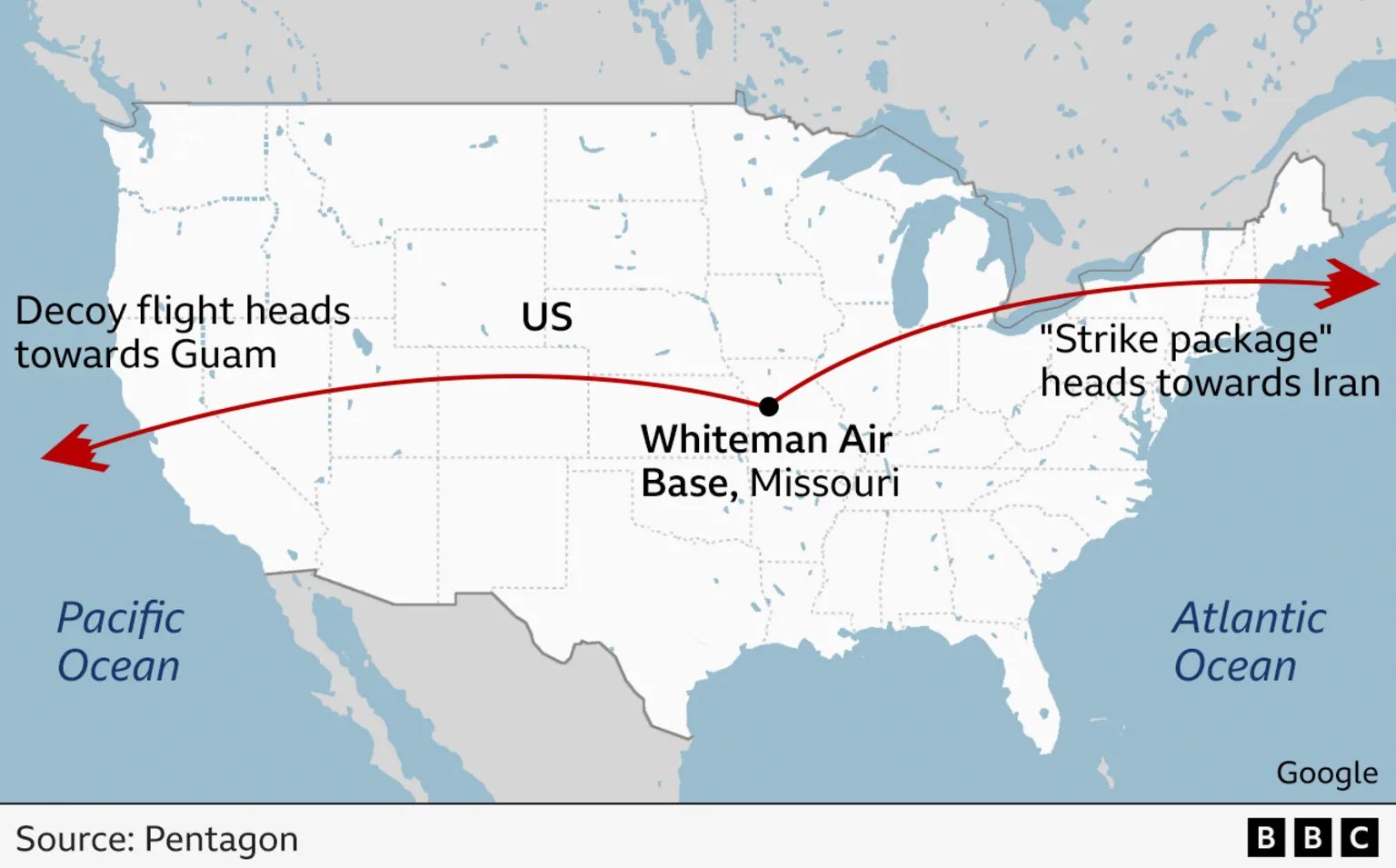
On June 22, after the strikes, General Dan Caine, chairman of the US Joint Chiefs of Staff, and US Defence Secretary Peter Hegseth held a joint press conference detailing the B-2 bombers' flight path.
General Caine explained that two sets of B-2 bombers were deployed. One group was used as a decoy that flew over the Pacific Ocean, while the actual strike aircraft travelled via the Atlantic Ocean and entered the Iranian airspace undetected via the Eastern Mediterranean.
A graphic released by the Pentagon during the press conference showed the real flight path entering Iran from the west, not the east — where Pakistan and India are located.
Reports featuring these flight maps have been published by PBS News, BBC, Reuters, and other media outlets.

General Cain's complete press conference can also be viewed here:
The map released by the Pentagon also shows that the flight path being cited by local media outlet was the one used for deception, which headed west towards the US base in Guam. While actual B-2 bombers that carried out the attack instead entered Iran from the west, nowhere near the Arabian Sea.
This was further confirmed by journalist Tahir Imran Mian, who told Geo Fact Check: “Based on these maps and other information available, I can say that Pakistani or Indian airspace was not used by the aircraft that were involved in directly attacking Iran.”
Neither has there been, to date, any public admission by US officials of using Indian airspace, as claimed by the Pakistani senator.
It is also important to note that both India and Pakistan have officially denied the use of their airspace in the operation.
The Indian government’s fact-checking arm, PIB Fact Check, posted on its official X handle that Indian airspace was not used by the United States during Operation Midnight Hammer.
Similarly, the fact-checking handle of Pakistan's Ministry of Information dismissed the claim of use of Pakistan's airspace as "fake news" as well.
Verdict: As per the information that is publicly available till now, therefore maps and flight paths provided by the United States, there is no indication that either Pakistani or Indian airspace was used in the US strike on Iran's nuclear sites.
Follow us on @GeoFactCheck on X (Twitter) and @geo_factcheck on Instagram. If our readers detect any errors, we encourage them to contact us at [email protected]
Image credit: ABC News