Karachi, Lahore brightest in Pakistan on NASA’s new nighttime map
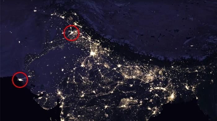
Pakistan’s two major cities – Karachi and Lahore – are two of the brightest spots in the country
April 16, 2017

It has been half a decade since the National Aeronautics and Space Administration (NASA) released an image of the Earth at night as viewed from the space. Yet its newest revelation shows us that Pakistan’s two major cities – Karachi and Lahore – are two of the brightest spots in the country.
On the Eastern side, New Delhi is quite the illuminated location in India.
Being a reflection of sorts of ourselves and our activities, of what our planet’s condition is at present, the agency’s latest project – with its first step being a video clip posted by the Goddard Space Flight Center – aims to take it further by collecting and analyzing daily images that will help understand tracking the change humans are making on the Earth.

Image credit: NASA Earth Observatory images by Joshua Stevens, using Suomi NPP VIIRS data from Miguel Román, NASA’s Goddard Space Flight Center
Led by scientist Miguel Román, the team at Goddard has been using newer, more advanced methods to improve the quality of images taken. It comes as part of the collaboration between NASA and National Oceanic and Atmospheric Administration (NOAA), wherein a satellite called Suomi National Polar-orbiting Partnership (NPP) carrying the Visible Infrared Imaging Radiometer Suite (VIIRS) was launched.
VIIRS, according to Universe Today, is “a 275-kg piece of equipment that […] detects photons of light in 22 different wavelengths. It’s the first satellite instrument to make quantitative measurements of light emissions and reflections, which allows researchers to distinguish the intensity, types and the sources of night lights over several years.”
In this regard, Román said, “Thanks to VIIRS, we can now monitor short-term changes caused by disturbances in power delivery, such as conflict, storms, earthquakes and brownouts,” the publication mentioned, adding that “gradual changes, driven by urbanization, out-migration, economic changes, and electrification”, can also be observed.
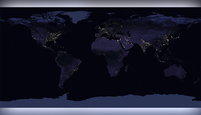
The images were created by combining various data sets that highlighted clearest nights in each of the 12 months.
Check out the rest of the world here:


