Erin expected to become category 5 hurricane, says US weather agency
Storm is currently 120 miles northeast of Anguilla, with maximum sustained winds of 145 mph
Published August 16, 2025
- Additional strengthening is expected this afternoon, says NHC.
- Leeward Islands, Virgin Islands, and Puerto Rico could see impacts.
- Swells will spread to Bahamas, Bermuda, US east coast next week.
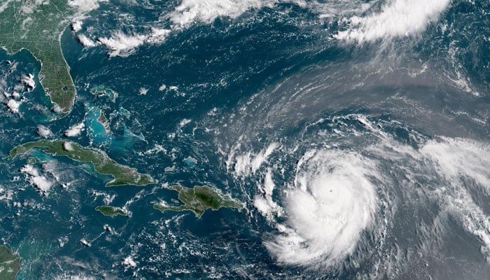
Hurricane Erin, which is the first hurricane of the 2025 Atlantic season and has developed into a dangerous Category 4 hurricane, has continued to rapidly intensify, the US National Hurricane Center (NHC) said on Saturday.
In a statement, the NHC said: “Additional strengthening is expected this afternoon and Erin could become a category 5 hurricane.”
The storm is currently 120 miles (193 km) northeast of Anguilla, with maximum sustained winds of 145 mph (233 kph).
Swells generated by Erin will affect portions of the northern Leeward Islands, the Virgin Islands, Puerto Rico, Hispaniola, and the Turks and Caicos Islands through the weekend, NHC said.
The swells will spread to the Bahamas, Bermuda, and the east coast of the United States early next week, it said.
Erin is expected to produce areas of heavy rainfall through Sunday across the northern Leeward Islands, the Virgin Islands, and Puerto Rico, the Center said.


