1,340km away from Karachi, 'Biparjoy' intensifies into 'Severe Cyclonic Storm'
There is no immediate danger to any coastal areas in Pakistan, says weather department
Published June 07, 2023
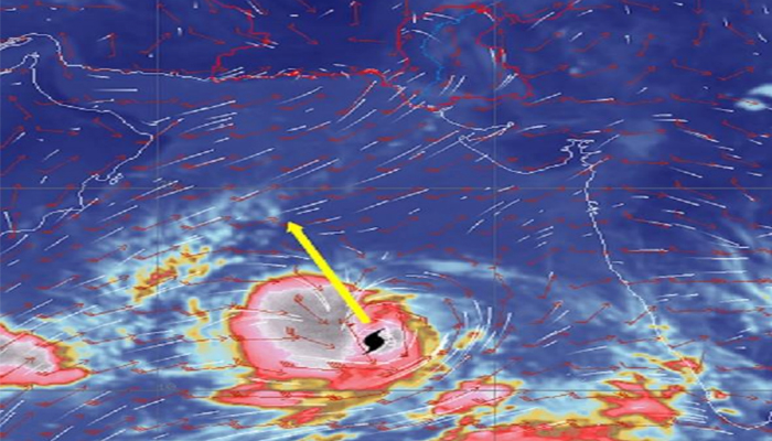
The Pakistan Meteorological Department (PMD) Wednesday forecast that tropical cyclone Biparjoy in the Arabian Sea has gained strength, reaching the status of a Severe Cyclonic Storm (SCS).
Currently, there is no immediate danger to any coastal areas in the country.
"The Cyclonic Storm (CS) “BIPARJOY” has moved northward during past 12 hours, intensified into a Severe Cyclonic Storm (SCS) and now lies near Latitude 12.8°N & Longitude 66.1°E about 1340km south of Karachi," the Met office statement read.
The Met Office reported that the system centre of the cyclone is experiencing maximum sustained surface winds of 90 to 100 kilometres per hour, accompanied by gusts reaching 120 kilometres per hour.
Due to the favourable environmental conditions (sea surface temperature of 30°C to 32°C, low vertical wind shear and upper-level divergence), the system is likely to intensify further into a Very Severe Cyclonic Storm (VSCS) in the evening or night today and will continue to move in north/northwest direction, the PMD mentioned.
"PMD’s cyclone warning center, Karachi is monitoring the system and will issue update accordingly," the Met office said.
A day earlier, the PMD issued a warning that there is a tropical cyclone potentially forming over Southeast Arabian Sea.
In an alert issued by the PMD on its website, the weather department said: “The low-pressure area (LPA) over Southeast Arabian Sea has intensified into a Depression (strong LPA) and lies near Latitude 11.5 N & Longitude 66.0 E about 1500km south of Karachi.”


