Japan on alert as Dujuan regains typhoon strength, with 1.6 million told to evacuate
Japan Airlines has reportedly cancelled 135 flights, while All Nippon Airways halted 140 of its flights
Published September 21, 2026
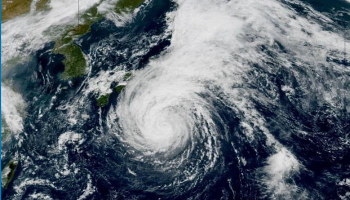
Tropical Storm Dujuan, which is moving along the coast of Japan without causing landfall, is still expected to make an impact.
Dujan gained typhoon status on Friday, September 18, before weakening to a trophical storm again on Sunday morning.
But the forecasters have predicted it would regain strength to a tropical storm by Tuesday morning with winds reaching 80mph, bringing along gusty winds of up to 100 mph, with sustained winds reaching 80mph (129 km/h).
The storm has led to flight cancellations, as hundreds of flights departing Japan have been cancelled.
Japan Airlines has reportedly cancelled 135 flights, while All Nippon Airways halted 140 of its flights.
The storm has also caused power outages, with Japanese authorities scrambling to make vacate the areas, with over 1.6 million residents urged to flee the areas across five prefectures, including the capital, Tokyo.
Some record-high rainfall estimates are expected, with about 200mm (7.9in) possible along the southern coasts of the Chubu and Kanto regions in just 24 hours, according to Japan's meteorological agency.
The Tokyo Metropolitan area is among the areas facing the heaviest rain, with some computer models suggesting it could receive nearly 90mm of rain within six hours on Monday evening.
Moving to south, the Izu peninsula is expected to receive over 80mm in just three hours—38% of the normal rainfall in a single evening.
Dujuan is forecasted to continue northeastwards before fading away in the north-west Pacific later this week.