Polar vortex forms over Arctic as Super El Niño raises winter uncertainty for US
New polar vortex could weaken mid-winter as historic El Niño strengthens
Published September 20, 2026
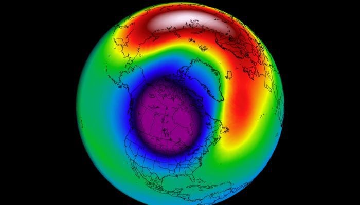
A polar vortex is forming above the Arctic in preparation for the winter season, where seasonal models predict that weakening is possible from January to February 2027 amid an El Niño of historical proportions, according to The Watchers and Severe Weather Europe.
Data from NASA indicate that the vortex became stronger up until mid-September, when zonal mean winds at 60° north reached 10.40 m/s on September 15 – higher than the climatological value of 8.10 m/s. As usual, the development of the vortex is normal as the Arctic stratosphere gets colder, trapping cold air over the pole.
On the other hand, ECMWF and UK Met Office seasonal guidance forecasted by Severe Weather Europe shows a noticeable weakening of winds in the stratosphere starting in January and continuing through February. The wind speed drops below the climatology, which implies a weak or disturbed state of the vortex – but not its sudden warming, where winds would reverse to an easterly direction.
This is associated with a very strong El Niño. On September 10, NOAA reported that there is more than a 90% probability of a very strong event this fall and winter, with a 75% probability that the October–December value is at least +2.5°C—possibly the strongest since 1950. According to studies by Manzini et al. (2024), very strong El Niño events may strengthen stratospheric response via planetary wave activity, but models show very wide disagreement in their estimates.
According to AccuWeather meteorologist Chad Merrill, speaking to Newsweek, the polar vortex is "just a small part of a bigger picture," and if it weakens from mid-January to February, it "could tip the scales toward a period of colder-than-normal temperatures" in the northern US, but "it doesn't always dictate the overall pattern in the winter during strong El Niño years."
Surface changes usually occur 10 to 30 days after stratospheric disturbances.