Hurricane Polo threatens Mexico after gaining 110 MPH in just 24 hours: How did it explode so fast?
The National Hurricane Center expects 3 to 6 inches of rain across coastal Guerrero and Michoacan through Thursday
Published September 23, 2026
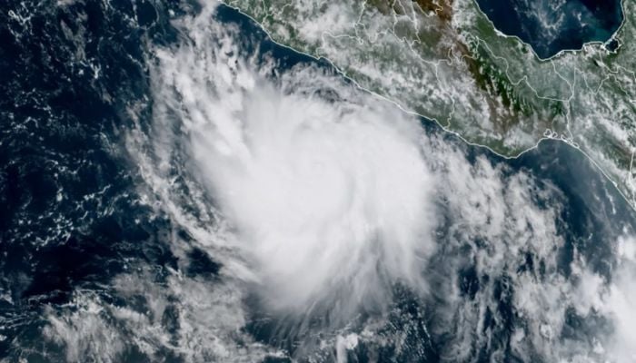
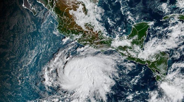
Hurricane Polo is now one of the most powerful storms on the planet, but barely two days ago it looked nothing like one.
On Monday morning, Polo was a tropical storm with winds of around 50 mph.
Twenty-four hours later, its winds had reached 160 mph. That 110-mph jump pushed Polo all the way to Category 5 and became one of the fastest periods of hurricane intensification ever recorded in the eastern Pacific.
At its peak on Tuesday, Polo's winds reached around 180 mph.
A Hurricane Hunter aircraft also measured its central pressure at about 892 millibars, an exceptionally low reading that placed Polo among the most intense hurricanes recorded in the basin.
Mexico is now beginning to feel its effects even though the hurricane may never make landfall.
The National Hurricane Center expects 3 to 6 inches of rain across coastal Guerrero and Michoacán through Thursday, with isolated areas receiving as much as 8 inches.
So how did it happen so quickly?
Polo found almost perfect conditions over the Pacific.
The National Hurricane Center said the storm moved across untouched ocean water warmer than 30.5C, while wind shear was weak and the surrounding atmosphere contained plenty of moisture.
Warm ocean water acts as fuel for hurricanes. With little disruptive wind above it, Polo was able to organise that energy around its small core remarkably quickly.
Its transformation came close to the rapid-intensification pace of Hurricane Patricia in 2015, which remains the strongest hurricane ever recorded in the Western Hemisphere by maximum sustained winds.
Polo has since fluctuated in strength but remains a major hurricane off Mexico.