World maps have lied for centuries, UN just voted to fix them
World map project under fire as UN backs equal Earth over Mercato
Published September 21, 2026
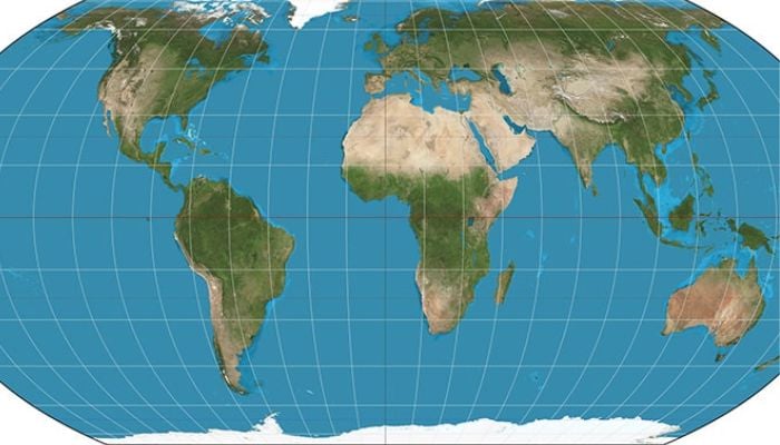
For generations, millions have viewed world maps that dramatically underrepresent Africa’s true size. A recent United Nations resolution has now thrust that distortion into the global spotlight, sparking fresh debate on how the world should be mapped.
At the heart of the issue is the Mercator projection, created by Flemish cartographer Gerardus Mercator in 1569. Designed for navigation, it preserves direction - making it invaluable to sailors - but enlarges landmasses near the poles while compressing the ones near the equator.
This results in the size of Greenland same as Africa on a standard Mercator map, when in reality Africa is 14 times larger.
The UN General Assembly adopted the "Correct the Map" resolution in September 2026 through a lopsided vote in favour by 164 nations, including France and the United Kingdom. The only state that opposed the motion was the United States, and there were six abstentions. The resolution was sponsored by Togo and supported by the African Union, advocates for equal-area projections such as Equal Earth, which was created in 2018.
No map is an accurate representation of the Earth due to its spherical shape. However, equal-area projections provide a better depiction of the Earth's true size in relation to land masses.
What is a Mercator map?
The Mercator projection is a map of the world created by Flemish cartographer Gerardus Mercator in 1569. Till now, it remains one of the most recognised world maps. It mathematically projects the three-dimensional spherical Earth onto a flat, two-dimensional surface, specifically a cylinder that is then unrolled. For this reason, it is also known as a “cylindrical projection.”