Hurricane Rachel's forecast path now reaches Southern California: what we know
Rachel’s remnants are forecast to make landfall in Southern California early Sunday morning, according to the National Hurricane Centre
Published October 08, 2026
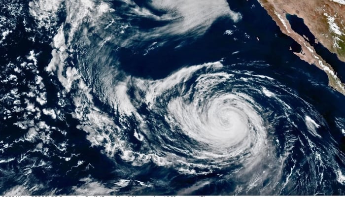
The National Hurricane Centre has extended the forecast path for Hurricane Rachel into Southern California on Wednesday, October 7, 2026.
The Miami-based agency classified Hurricane Rachel as a Category 1 storm, with its forecast cone now reaching the Golden State.
While it won’t be a hurricane by the time it reaches California this weekend, Rachel could still bring dangers similar to a tropical cyclone, including rainfall, strong winds, big currents and other impacts, according to the National Oceanic and Atmospheric Administration (NOAA).
Rachel’s remnants are forecast to make landfall in Southern California early Sunday morning, the NHC has said, bringing moisture to the region through as late as Tuesday, October 13.
The “cone of uncertainty” highlights the possible path of the centre of the storm as far north as Anaheim, but the hurricane centre observed that “hazardous conditions can occur outside of the cone.”
The rain is expected from Rachel’s moisture at 9 a.m. Sunday, October 11, through 9 a.m. on Monday, October 12, in Los Angeles and Ventura counties, NOAA forecasts.
The most rain is expected in eastern portions of the L.A. County mountains, which could receive up to 2 inches of rain, NOAA said.
Hurricane Rachel is already increasing the danger of rip currents along most of the Southern California coast.
As the storm gets closer, Orange and San Diego counties are the most likely to experience strong winds and potentially damaging waves.
By the weekend, the forecasters have predicted it would drop to tropical storm strength.