Tropical storm Edouard prompts school closures across Houston: See full details
Flooding, heavy rain force school shutdowns as Tropical storm Edouard approaches
Published September 01, 2026
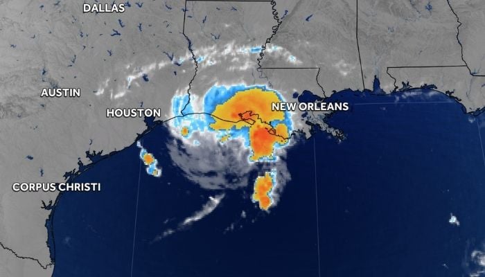
Tropical Storm Edouard is intensifying in the Gulf of Mexico as it barrels toward the upper Texas coast, prompting several school districts across Southeast Texas to cancel classes Tuesday, September 1.
The National Hurricane Center reports that Edouard has maximum sustained winds of 40 mph and is moving west-northwest toward the Texas-Louisiana border.
As suggested by forecasters, there is a major strengthening expected with the storm approaching hurricane strength before making landfall Tuesday evening.
School districts, including Anahuac, Channelview, Cleveland, Crosby, Dayton, Galena Park, Goose Creek CISD, Humble, Liberty, and Sheldon ISDs, have announced full closures. Others who were affected include Willis ISD, who have opted for early dismissals. Lee College and other educational institutions have also suspended operations.
Governor Greg Abbott stated that “Weather conditions could deteriorate rapidly Tuesday afternoon,” stressing that “saving lives is the most important thing.”
This area is at the greatest danger from rain and flooding compared to winds. According to NHC, this area will experience 3-6 inches of rainfall with possible amounts up to 9 inches. Rainfall rates can reach up to 3-4 inches per hour within the heaviest rain bands.
A hurricane watch and storm surge warning were issued for the upper Texas and southwestern Louisiana coasts. A storm surge can cause water levels to rise between 3-5 feet above ground.
CenterPoint Energy opened its emergency operation center and made preparations for power outages. Harris County Office of Homeland Security & Emergency Management recommends that residents be weather alert and subscribe to ReadyHarris alerts.