Current cold snap isn't polar vortex: Here's what it really is
Meteorologists watch stratosphere, predict major cold outbreak by February
Published January 16, 2026
As cold and intense in the Midwest and Great Lakes, there have been speculations about the actual cause behind the harsh weather.
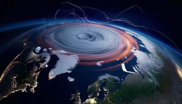
The major culprit is the polar vortex. The polar vortex is an area of low pressure, a wide expanse of swirling cold air, that is parked in polar regions.
In winter, the Polar Vortex at the North Pole expands and pushes cold air southward. This is quite a regular occurrence and can be linked to the outbreak of cold weather in the USA.
However, meteorologists stress that this week’s bitter cold is not due to the disruption of the stratospheric polar vortex.
Instead, it is being driven by a southward dip in the jet stream, pulling cold surface air from Canada into the eastern U.S.
This pattern, reinforced by fast-moving Alberta clipper systems, is a tropospheric weather event occurring miles below the stratospheric polar vortex.
Meteorologists state that the true polar vortex is rather a large-scale, high-altitude cyclone of cold air that typically circles the Arctic.
Although the polar vortex didn’t cause the current cold, it is anticipated to bring an even colder forecast in late January.
New high-resolution models suggest a major stratospheric warming event that could deform the vortex, potentially open the “Arctic floodgates” and direct the coldest air of the season into North America and Europe by early February.


