Super El Niño 2026: Which regions will be hit hardest?
Powerful El Niño is expected to emerge by mid-2026 (May-July)
Published May 14, 2026
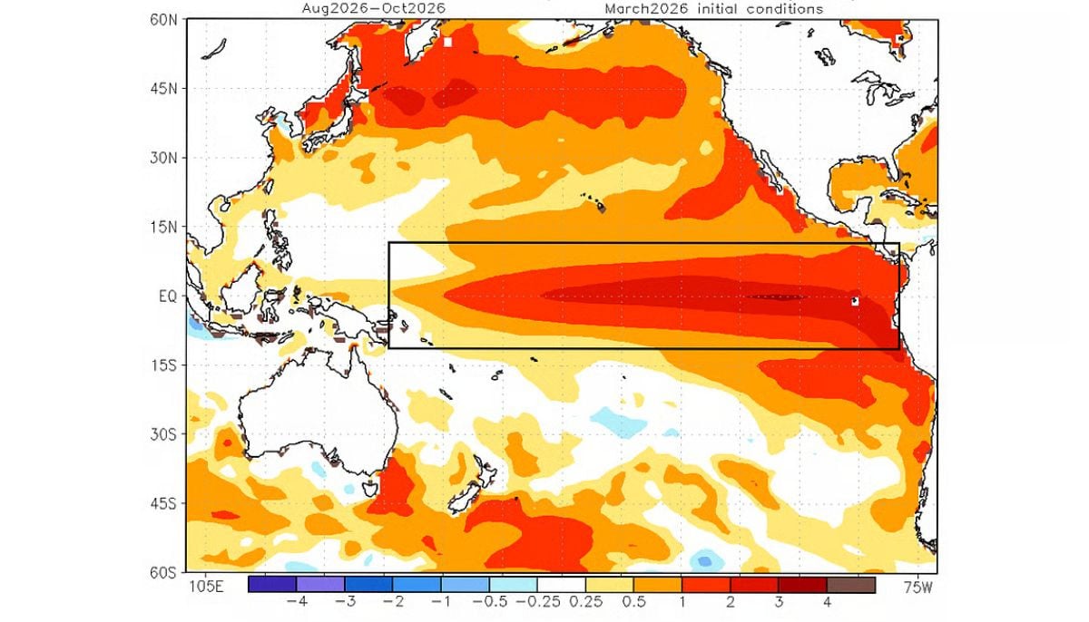
A super El Niño is rapidly intensifying in the tropical Pacific Ocean and is about to hit hardest around mid 2026 (May-July).
The meteorologists warn that the five global regions will be impacted most, causing catastrophic weather conditions.
It has been found that sea surface temperatures have already warmed to 0.5 degrees above normal, triggering super El Niño conditions.
Forecasters from NOAA, the European Centre of Medium-Range Weather Forecasts, and Australia’s Bureau of Meteorology all come up to the unified stance that this El Niño will be the strongest ever recorded in history.
Some models even predict that the temperature can exceed 2.5 degrees by autumn.
Although it has global effects, the hardest hit regions are:
Southern United States (flood risk)
Whereas the Pacific Northwest will stay dry, areas along the southern strip stretching from California to Florida can expect an increase in storms during the winter season. Areas experiencing drought may enjoy some respite, but this is worrying when it comes to flooding and severe weather conditions.
Southeast Asia (Drought threat)
As warmer water shifts east, the western Pacific remains cooler. There is less thunderstorm activity, minimising monsoon rainfall across Indonesia, the Philippines, and surrounding nations. There are higher chances of drought, threatening water supplies and agriculture.
Australia (Dry winter)
Cooler waters off Australia’s northern and eastern coasts minimise moisture, enabling high-pressure systems to dominate. The result is drier-than-normal conditions that are harmful for farming and water reserves, along with an increased risk of winter frosts.
Atlantic Basin (Hurricanes)
There are two primary reasons why El Niño tends to hinder the development of hurricanes within the Atlantic Ocean: dryness in western Africa will lead to fewer thunderstorm clusters entering the Atlantic, and wind shear will disrupt the process of storm creation. Nevertheless, meteorologists caution that one storm could cause massive damage.
Southeastern South America (Increased summer rainfall)
Regions of Argentina, Paraguay, Uruguay, and southern Brazil usually see heavier summer precipitation. While this is beneficial for agriculture, these patterns can elevate risks of flooding and severe weather.
The last strong El Niño occurred in 2015-2016, which experienced three-month average temperatures reaching 2.4 degrees Celsius above normal, contributing to record global heat. Scientists warn that 2027 can be the warmest year on record.

 down? Here's what we know")


