Simi Valley Sandy Fire cause revealed: See full evacuation map here
A temporary evacuation point will open at 12 p.m. at the Rancho Santa Susana Community Park
Published May 19, 2026
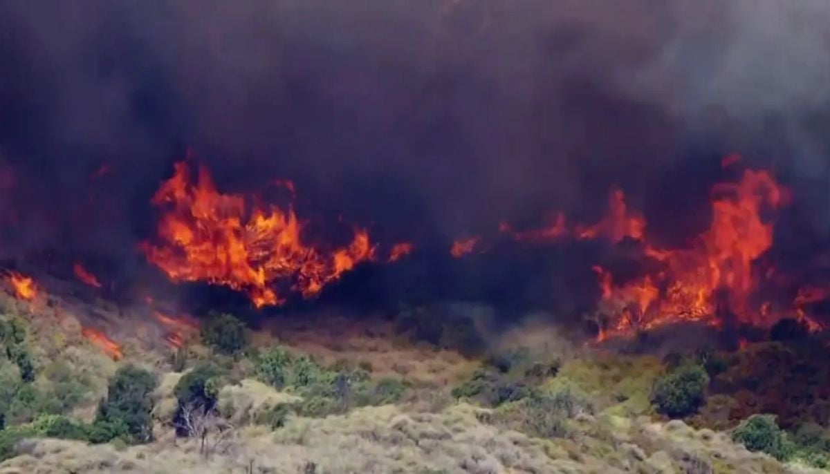
A Sandy Fire, also known as bush fire, erupted in Simi Valley on Monday and scorched over 500 acres of land, prompting authorities to issue evacuation orders.
According to the initial investigation by the police, the possible cause of fire could be a tractor striking a rock, which may have sparked the fire at around 10:30 a.m. The fire quickly spread across the 600 block of Sandy Avenue.
The Simi Valley Unified School District updated that all students are safe and have been sheltering in places at nearby schools.
Here’s a detailed map of evacuation order issued by the fire department:
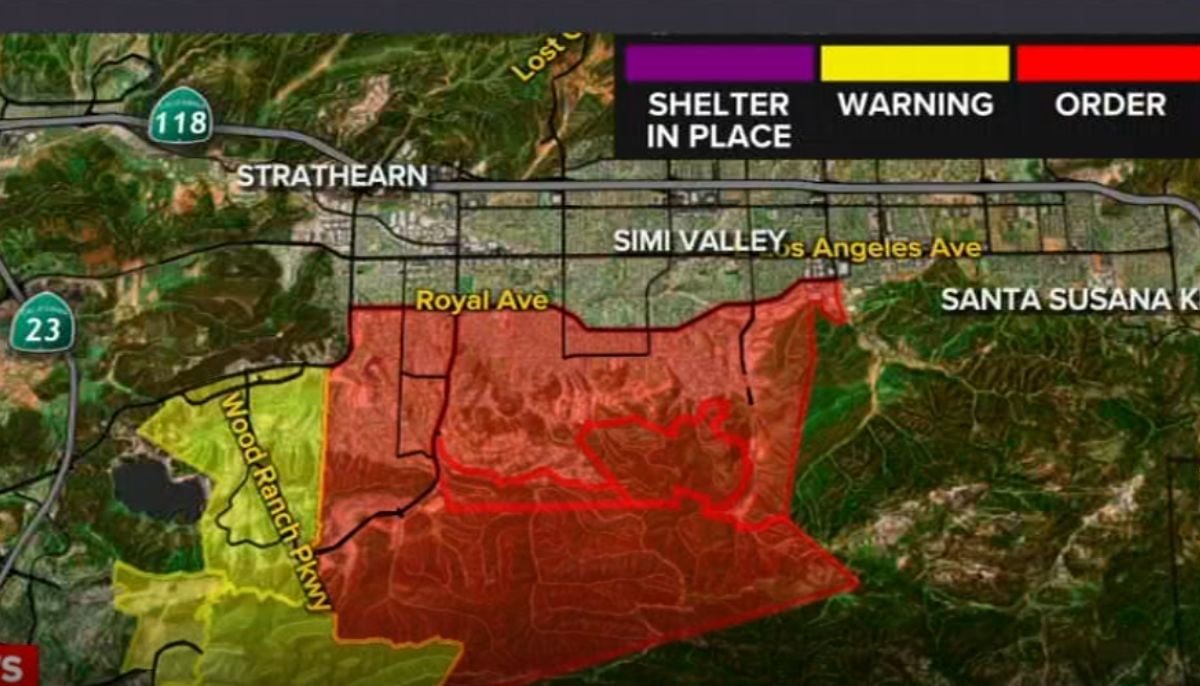
The following zones are under an evacuation order:
- Simi Valley 32
- Simi Valley 33
- Simi Valley 34
- Simi Valley 35
The following zones are under an evacuation warning:
- Simi Valley 31
- TOAKS 6
- TOAKS 7
Meantime, a temporary evacuation point will open at 12 p.m. at the Rancho Santa Susana Community Park, located at 5005 Los Angeles Avenue. A large animal shelter is open at Ventura County Fairgrounds, located at 10 E Harbor Blvd.
Firefighters have been working tirelessly to control the blaze but the strong winds proved to be a major challenge. Fortunately the wind speed was not extreme, allowing crews to launch aerial firefighting missions.
The Fire Department’s Public Information Officer said five helicopters and three air tankers were deployed to control the Sandy Fire.
At the time of publishing this report, the fire has been 0 percent contained.


